Golf course drainage and slope mapping, from a drone flight.
See where the water goes and how steep the ground is, on every hole, from your desk. Course Correct derives slope classes, 0.5 m contours, and water flow paths from drone elevation data of your course and lays them over the same 3D model your crew works from.
What gets mapped
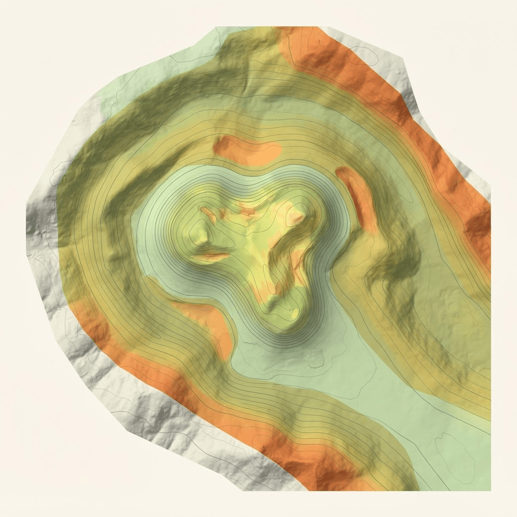
Five terrain layers come out of one capture.
Slope classes
Each hole shaded in four classes: under 2%, 2 to 5%, 5 to 10%, and over 10%.
Contours
Contour lines at a 0.5 m interval, draped on the 3D hole.
Elevation bands
The hole shaded from its lowest ground to its highest, so its shape reads at a glance.
Flow paths
Where surface water runs, traced from the elevation data and graded from minor runs through collectors to main channels.
Wet areas
A layer on the aerial map that marks where water is likely to collect.
What crews use it for
Drainage work starts with the line the water actually takes. Flow paths show where runoff gathers and where it ends up, so you can see what feeds a wet spot before deciding where a drain or a regrade belongs.
Slope maps put a number on the ground. You can see which banks are over 10%, where a fairway is flatter than 2% and slow to shed water, and how grade lines up with wear and mowing trouble. Argue from the model, not from memory.
When something needs attention, pin it on the hole and assign it. See course issue tracking.
How it is made, and what it cannot see
Every layer is computed from a drone photogrammetry capture of your course. Slope and flow are worked out on a half-meter grid.
Photogrammetry records the surface the camera sees. On mown turf that is the ground. Under tree canopy and in tall native grass it is the vegetation, so treat a flow path there as a reason to go and look.
The layers model surface flow from the shape of the land. They know nothing about pipes, catch basins, or soil. A wet area the model cannot explain is its own finding: it points below the surface. Our guide on finding drainage problems with elevation data walks through reading those mismatches.
Who sees it
Slope classes and drainage are staff layers. They sit behind sign-in, with roles the club controls. Golfers and website visitors open the same twin without them.
From a map to a measurement
The layers show the pattern. The measuring tools answer the specific question: the grade between two points in percent and degrees, or the elevation profile along a line you draw across a swale. They are covered under renovation planning.
All of it is indicative, not survey-grade. Use it to find problems and set priorities, and have engineered drainage design checked against a licensed survey.
Questions about slope and drainage mapping.
Yes, for surface drainage on open ground. Elevation data from a drone flight shows where water runs across the surface and where it collects. It does not show pipes or what is happening in the soil, and under trees it records the canopy and not the ground.
Four: under 2%, 2 to 5%, 5 to 10%, and over 10%. Contours are drawn at a 0.5 m interval.
No. The flow paths are modeled from the shape of the surface. A spot that stays wet where the model shows water leaving is a sign to check for a blocked drain, a leak, or a soil problem.
It is working detail for finding problems and setting priorities. It is indicative, not survey-grade, so engineered drainage design should be checked against a licensed survey.
Course staff. Slope classes and drainage sit behind sign-in, with roles the club controls. Golfers do not see them.
It shows the ground as it was on the day of the flight. After earthwork or a rebuild, the affected holes need to be flown again.
How to find golf course drainage problems
A method for finding golf course drainage problems with elevation data: trace the flow paths, find where water stops, and read what the wet spots tell you.
ReadPlatformGolf course maintenance issue tracking on a 3D map
Issue tracking for golf course superintendents: pin a problem on the 3D course with a photo, priority, assignee and due date, then work it from one board.
ReadPlatformGolf course renovation planning with cut and fill
Plan a golf course renovation on a 3D model of your own course: measure distance and grade, draw cross-sections, and estimate cut and fill in the browser.
ReadBook a demo.
We'll walk you through a live course twin: the staff tools, the golfer experience, and how it sits on a website. Then we map out what your course would involve. Bring your team and decide from there.
- A live twin in the browser, not a slide deck
- Issues, terrain layers, and measuring tools on a real course
- The golfer experience and the website embed