Green guides: every green on your course, read.
A green guide is a digital green book: a contour map of the putting surface that shows which way it falls and by how much. Course Correct makes one for every green from the same drone capture as the 3D course, and golfers open it in a browser with no app.
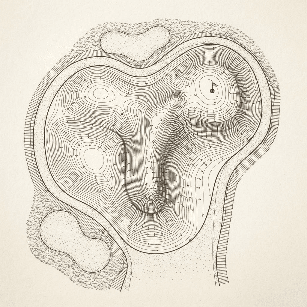
What a golfer sees
Each green can be read three ways. Break shows contour lines with arrows for the direction and severity of the slope. Numbers puts slope figures on it. Thermal shades the surface by elevation, from low to high.
Tap anywhere on the green for the slope at that spot. The guide can be turned to face the line of play, so the green appears the way it does from the fairway, or set north-up.
The break to the pin
Tap to place a pin and the guide draws the fall lines around it, with the straight uphill and downhill line through the cup.
Course staff can publish a hole location, and every golfer who opens that green then sees the break to it. A golfer can also set a pin of their own, which stays on their device for the day.
On screen or on paper
The guides print. One green prints as a sheet, and the whole course prints as a green book.
How the guides are made
Each guide is computed from drone elevation data of the actual putting surface, read on a one-yard grid. Nothing is drawn by hand or from memory.
A green is closely mown and open to the sky, which is the surface drone photogrammetry records best. Our guide to photogrammetry and LiDAR for golf courses explains why. A guide shows the green as it was on the day of the flight, so a rebuilt green needs to be flown again.
Using a green guide in competition
The Rules of Golf limit the green-reading materials a player may use during a round, and a committee can restrict them further by Local Rule. Check what applies to your competition. Before the round, and in casual play, golfers can study the greens as much as they like.
Part of the same twin
Green guides are one layer of a golf course digital twin. Golfers reach them from the same link as the hole tours, the yardages, and the AI caddie, which can use the slope of the green and the published pin in its answers.
Questions about green guides.
A contour map of a putting green that shows which way the surface falls and by how much. A Course Correct green guide adds a slope reading wherever you tap and the break to a pin position.
It is the same idea in digital form. A printed green book shows fixed slope arrows for each green. A green guide is interactive: tap for the slope at a spot, set a pin, and see the fall lines to it. It can also be printed as a sheet or a whole-course book.
Slope is read on a one-yard grid, computed from centimeter-scale drone elevation data of the green. It is working detail for play and course setup, not a licensed survey.
Yes. Course staff publish a pin position for a green, and golfers who open that green see the break to it.
No. Green guides open in a phone or desktop browser from a link, with no account and no app.
That depends on the Rules of Golf and any Local Rule in force, which limit the green-reading materials a player may use during a round. Check with the committee for your competition.
AI caddie for golf clubs, grounded in your course
An AI caddie for your golf course that answers from each hole’s own data: yardages by tee, hazards, the slope of the green and the pin. No app, no account.
ReadPlatformGolf course digital twin: your course as a 3D model
A golf course digital twin is a measurable 3D model of every hole, built from a drone flight. What is in one, how it is made, and who at the club uses it.
ReadGuideDrone photogrammetry vs LiDAR for golf course mapping
What drone photogrammetry and LiDAR each measure on a golf course, where each one struggles, and which to choose for drainage, renovation and 3D course models.
ReadBook a demo.
We'll walk you through a live course twin: the staff tools, the golfer experience, and how it sits on a website. Then we map out what your course would involve. Bring your team and decide from there.
- A live twin in the browser, not a slide deck
- Issues, terrain layers, and measuring tools on a real course
- The golfer experience and the website embed